|
19th IIRS Outreach Programme on
|
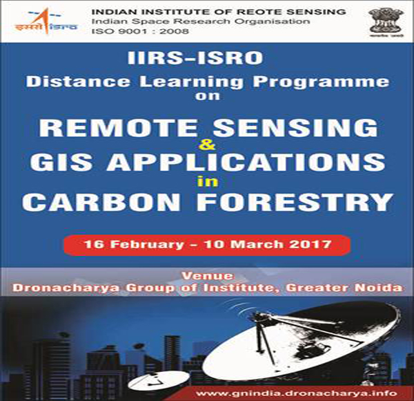
Remote Sensing and GIS Applications in Carbon Forestry
|
16th February - 9th March, 2017
|
|
| |
Indian Institute of Remote Sensing (IIRS), Dehradun in association with Indian Space Research Organisation (ISRO) conducted the 19th IIRS Outreach Programme on Remote Sensing and GIS Applications in Carbon Forestry during 16th February - 9th March 2017. |
| |
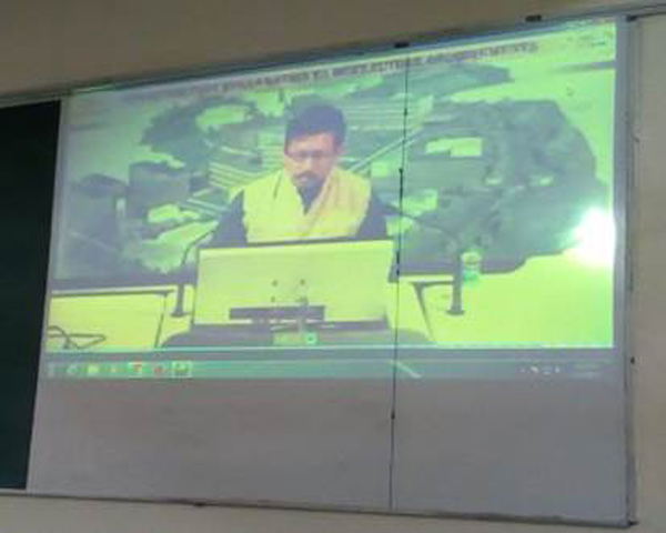
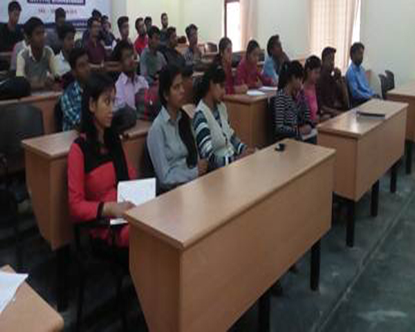
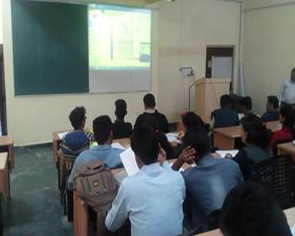
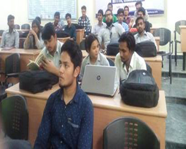
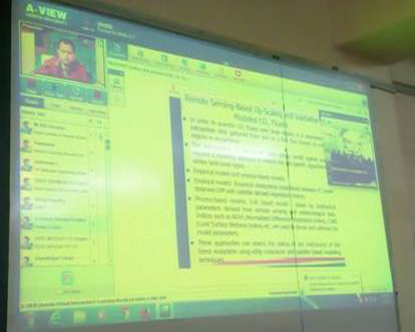
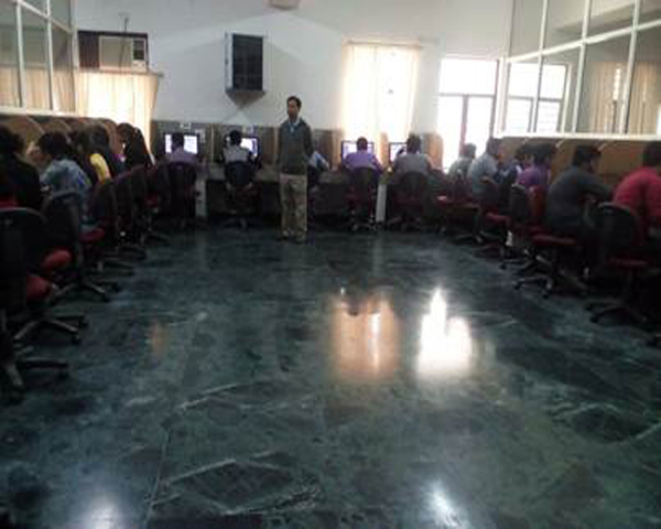
The Outreach Programme was organized at Dronacharya Group of Institutions, Greater Noida through A - View. 14 lecture sessions were conducted from 3:30 PM to 4:30 PM on event days. 61 students from B. Tech. CSE / IT / CE / ECE enrolled for the Outreach Programme. Dr. Somnath Sinha was the Local Faculty Coordinator for the session. |
| |
Day 1: 16th February 2017
Dr. S. K. Srivastav - GD GTOP Group gave a brief about IIRS DLP activities. Dr. Sarnam Singh - Scientist SF Forestry and Ecology described about 19th IIRS Outreach Programme and major course objectives. Course content of 19th IIRS Outreach Programme was explained by course coordinator Dr. Hitendra Padalia. Dr. A Senthil Kumar - Director IIRS also addressed the students. |
| |
Dr. Arijit Roy - Scientist SF Forestry and Ecology Department started the lecture session with the “Global Carbon Cycle & Climate Change : An overview”. He described nation of the long- and short-term global climate change, and the possible anthropogenic contributions to such change. |
| |
Day 2: 17th February 2017
Dr. Stutee Gupta - Scientist SF Forestry and Ecology Department conducted the session on “Forest Based Strategies for Mitigating Climate Change”. She said that woodlands and forests contain substantial carbon in soil, trees and other vegetation and they are hugely important to the carbon, water and energy cycles. Removing forests releases CO2 into the atmosphere, while growing trees absorb CO2 from the air. Other Greenhouse Gases (GHG) such as methane and nitrous oxide are also exchanged between forests and the atmosphere. She stressed that the functioning and management of forests are critical in reducing the net GHG emissions into the atmosphere. |
| |
Day 3: 20th February 2017
Dr. Hitendra Padalia - Scientist SF Forestry and Ecology Department discussed “Global Earth Observation Initiatives for Carbon Forestry”. His lecture covered on Global Earth Observations Initiatives, Global Forestry Observation Initiatives, initiatives on Web - based Information Dissemination and Indian Initiatives on Carbon Forestry. |
| |
Day 4: 21st February 2017
Dr. Sarnam Singh discussed on the topic “Spectral Signature of Vegetation and factors affecting the Spectral Response”. His lecture was focused on Spectroscopy, Electromagnetic Spectrum, and reflection property of tree and Interaction of energy with the earth surface. |
| |
Day 5: 22nd February 2017
Dr. Stutee Guptaconducted the session on “Application of Satellite Remote Sensing in Mapping and Monitoring of Forest Cover and Land Use”. Her lecture covered Forest Cover in India, Role of Remote Sensing, Important Considerations in Forest Mapping, Glimpse of Indian Forest Cover Mapping Exercises, Forest Change Detection and Case Studies. |
| |
Day 6: 27th February 2017
There were two sessions on the sixth day. In the first session Dr. Arijit Roy discussed “Application of Satellite Data in Forest Sampling Design for Biomass / Carbon Quantification”. His lecture stressed upon Forest Management, Forest Inventory, Elements of Forest Inventory, Sampling and Stratification of the Vegetation. |
| |
In the second session Dr. Hitendra Padalia discussed “Application of Satellite Remote Sensing in Mapping and Monitoring of Forest Degradation”. He focused on Forest Degradation Status, Causes & Drivers of Forest Degradation, Forest Degradation Assessment: Traditional Approach, Approaches for Assessing Forest Degradation using Remote Sensing. |
| |
Day 7: 28th February 2017
Dr. Subrata Nandy - Scientist SF Forestry and Ecology Department conducted the session on “Application of High Resolution Data for Biomass / Carbon Inventory”. He explained remote sensing - based approach for tree carbon stock assessment, it’s advantage over traditional methods, some of the VHR satellite / Sensors, the crown projection area (CPA) of a tree, relation between CPA and Carbon and Carbon Stock. |
| |
Day 8: 1st March 2017
Dr. Sarnam Singh discussed “Application of Optical Remote Sensing in Forest Biomass and Carbon Assessment”. He explained the definition, significance, need of biomass and carbon assessment using planning, vegetation type and density mapping, sampling, field data collection, data organization, analysis and modeling and upscalling. |
| |
Day 9: 2nd March 2017
Dr. Subrata Nandy explained “Application of LiDAR in Mapping of Forest Structure and Biomass / Carbon Estimation”. He briefly described LiDAR Concept, Types of LiDAR, Terrestrial LiDAR, TLS Applications in Forestry and Data Acquisition using TLS. |
| |
Day 10: 3rd March 2017
Dr. Hitendra Padalia discussed “Application of Microwave Remote Sensing in Forest Biomass / Carbon Estimation”. He gave a brief overview of microwave remote sensing, Processing of microwave data, response of forests in microwave region and estimation of biomass / carbon. |
| |
Day 11: 6th March 2017
Dr. Subrata Nandy delivered a lecture on “Application of Eddy Covariance Technique in Carbon Flux Measurement and Modelling”. He explained the eddy covariance technique for estimating CO2 fluxes, Tower-based flux measurements, role of remote sensing in up - scaling the information, the use of parameters derived from new satellite sensors along with improved modeling approach and long - term pursuance of flux site. |
| |
Day 12: 7th March 2017
Dr. Arijit Roy discussed “Geoinformatics for Near-real Time Forest Fire Assessment and Monitoring”. He explained Forest fires - India, Indian Forest Fires: Anthropogenic activity, Use of Space Technology for Forest fire Management, Identification of active fire locations and Forest fire monitoring using satellite data. |
| |
Day 13: 8th March 2017
Dr. Stutee Gupta - Scientist SF Forestry and Ecology Department conducted a session on “Application of Satellite Remote Sensing in Forest Biomass Burning and Carbon Emission Monitoring”. She explained Biomass, Forest & Carbon Neutrality, Methodological Issues in Measuring Emissions and Approaches to estimate C emissions, Role of Remote Sensing including Case Studies. |
| |
Day 14: 9th March 2017
Dr. Stutee Gupta discussed “Application of Geo-web Portals and Services in Forestry Studies”. She explained what is a Geoportal, Components of a Geo - Portal, Functionality for End Users, Functionality for Geoportal Management, Functionality for Geoportal Data Security, Functionality for Geoportal Interoperability, and Classification of Geo - portal. |
| |
Final day: 20th March 2017
Online Examination of 19th IIRS Outreach Programme on Remote Sensing and GIS Applications in Carbon Forestry was conducted on 20th March 2017 at 12:00 hrs. 60 MCQs of 1 Mark each was asked which was to be attended in 60 minutes. |
|
|
|
|
|
|
|
|
|
|
|
|
| |
|
|
|
| |
|
|
|
| |
 |
Click here to View Events & Seminars 2017 |
|
| |
|
Click here to View Events & Seminars 2016 |
|
| |
|
Click here to View Events & Seminars 2015 |
|
| |
|
Click here to View Events & Seminars 2014 |
|
| |
|
Click here to View Events & Seminars 2013 |
|
| |
|
|
|